Learn to calculate construction productivity losses from adverse weather. Apply our effective productivity formula to optimize project scheduling and output.
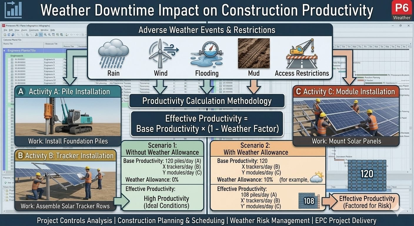
Learn to calculate construction productivity losses from adverse weather. Apply our effective productivity formula to optimize project scheduling and output.
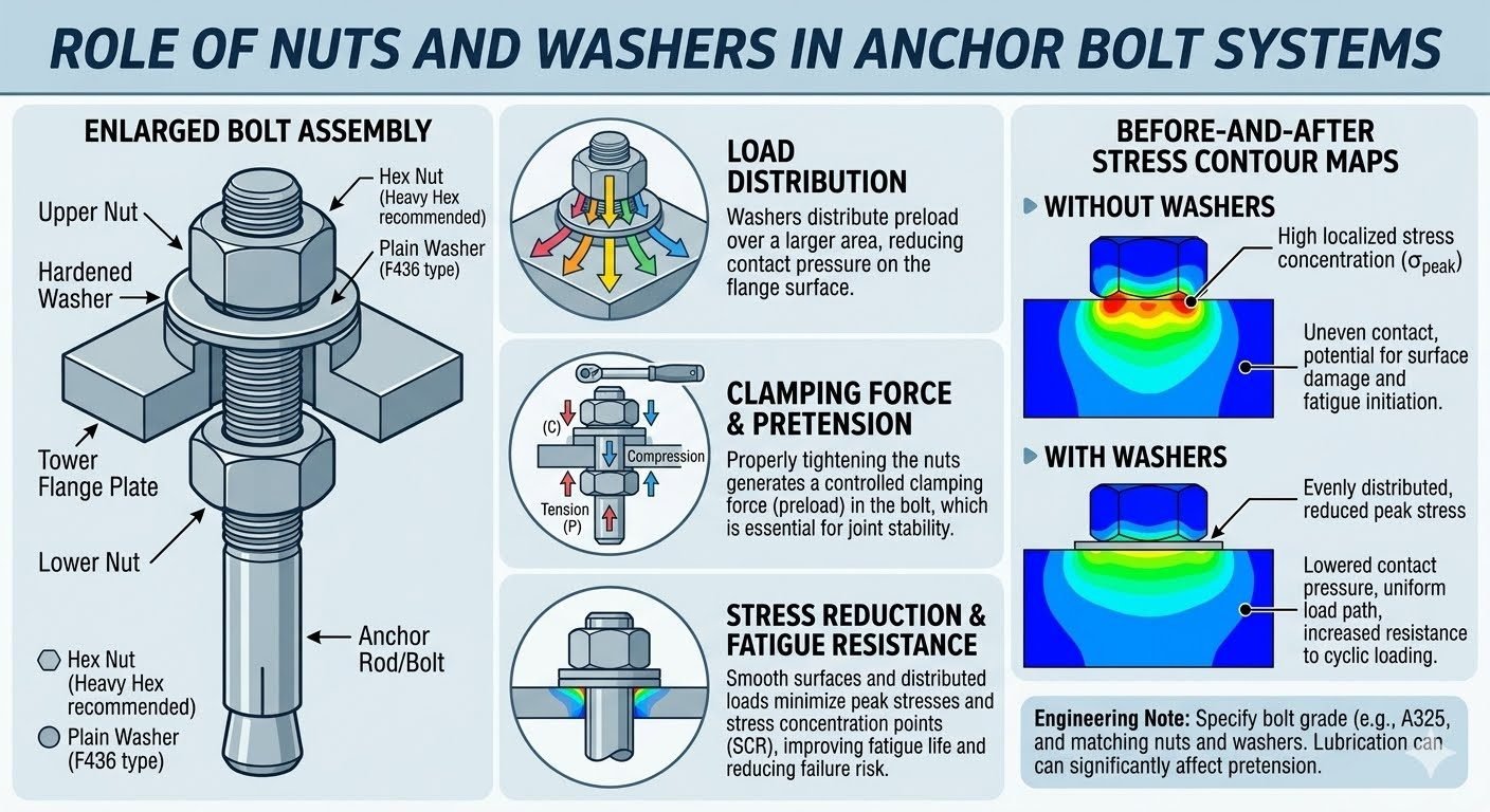
Master wind turbine foundation anchor cage assembly with this guide. Learn fabrication steps, leveling methods, and load transfer standards.
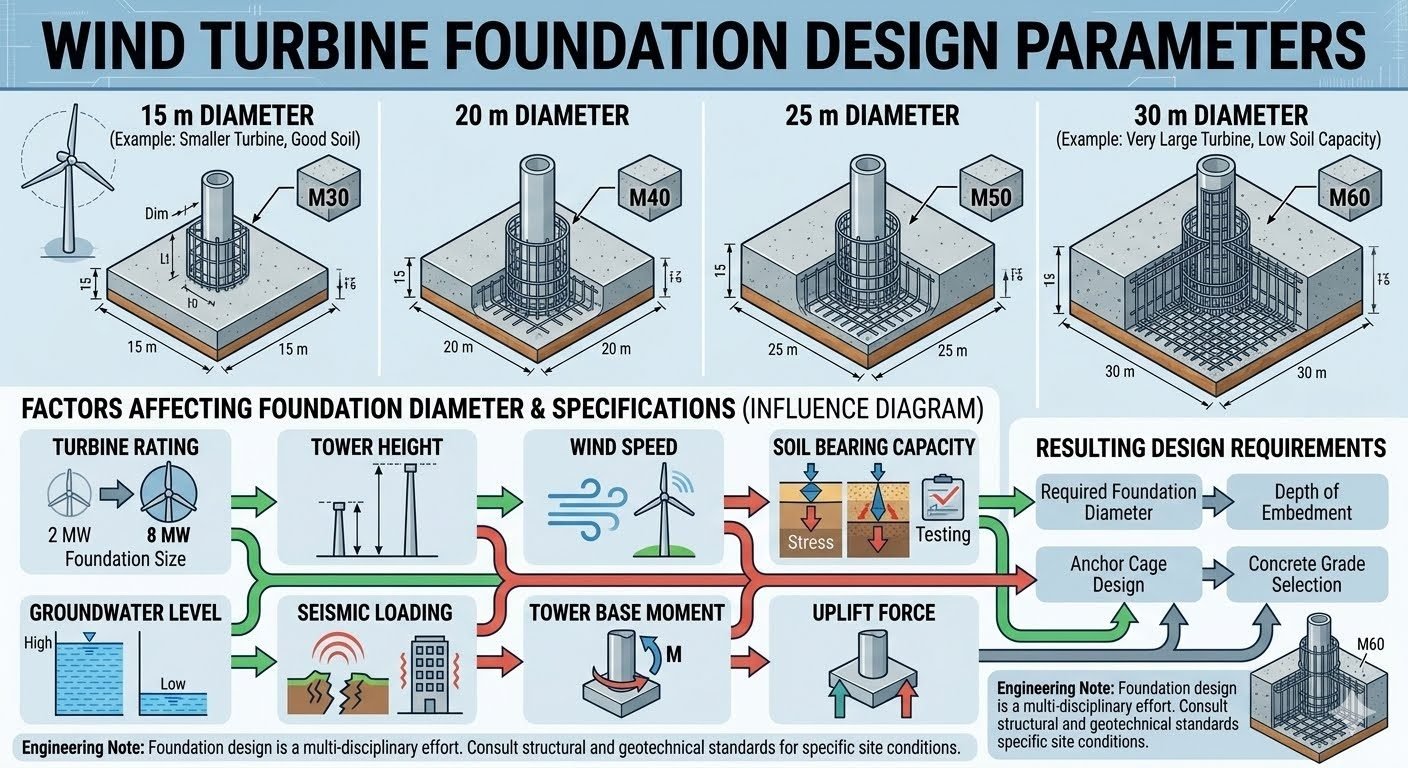
Master anchor bolt cage verification before foundation pours. Learn to check bolt circle diameter, vertical alignment, and elevations per ASME standards.
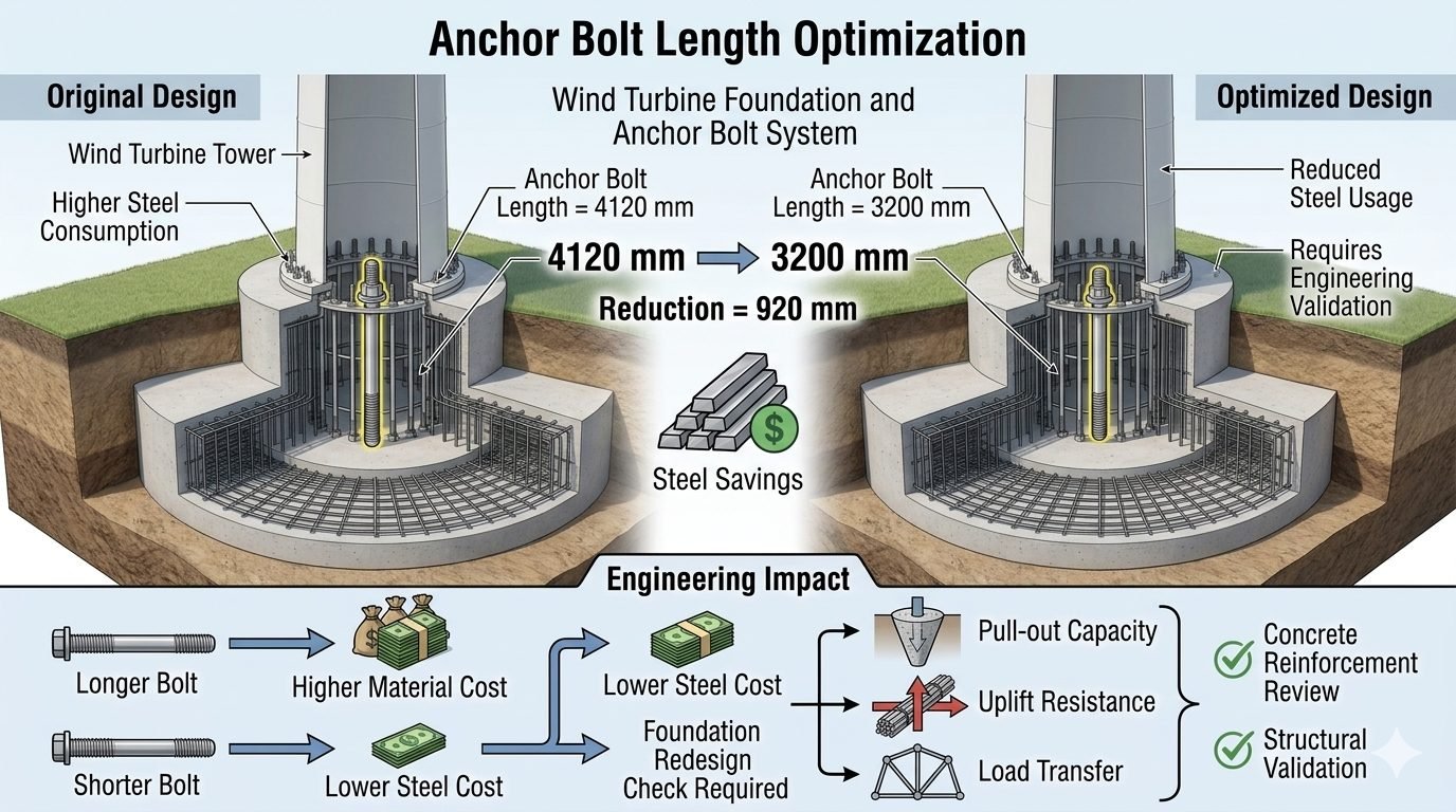
Discover anchor bolt length optimization techniques to cut steel costs by 920mm while ensuring uplift and pull-out safety per ACI 318 standards.
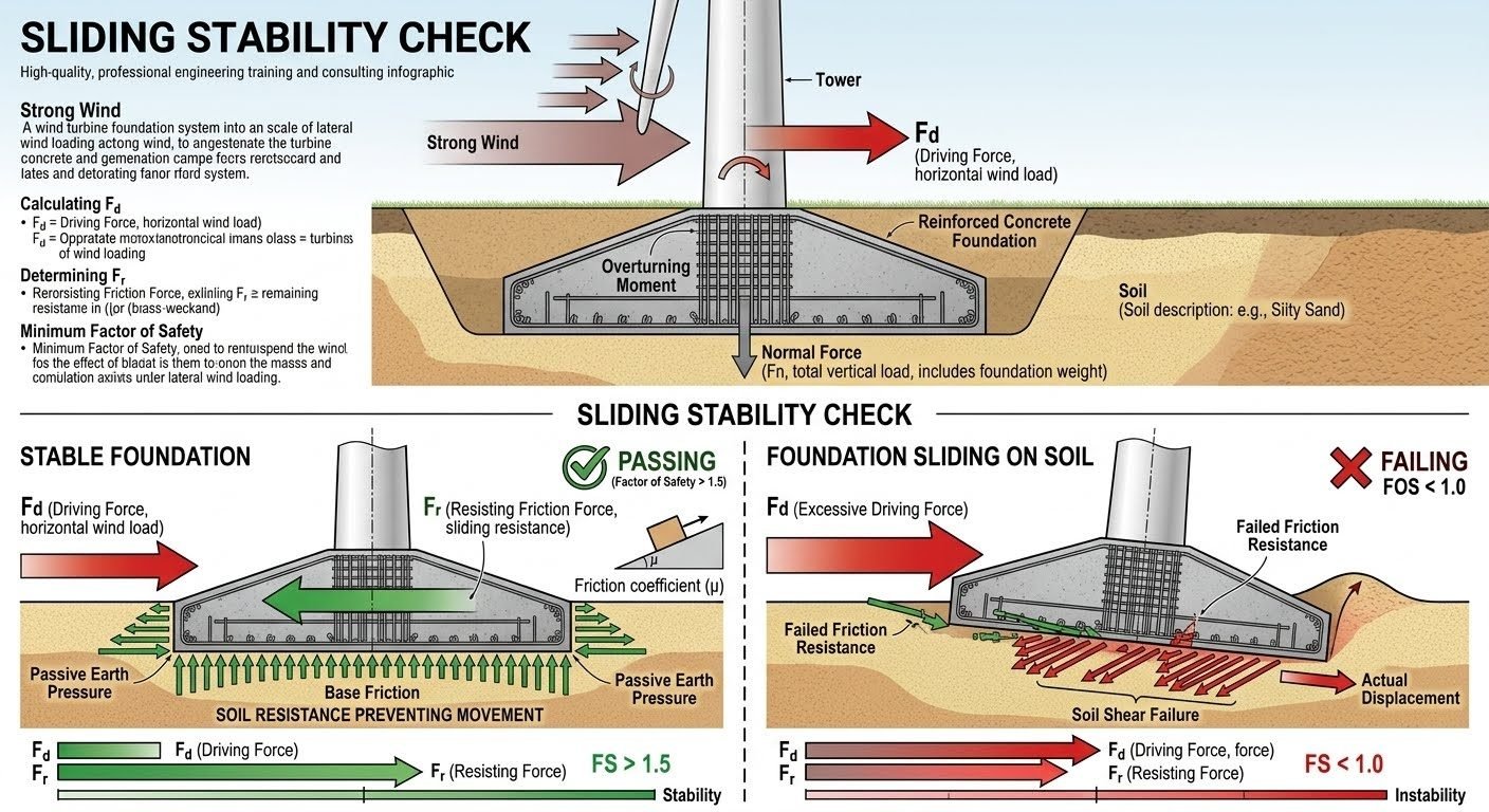
Master the sliding stability check for industrial foundations under extreme wind load using ASME and ACI engineering standards to prevent lateral failure.
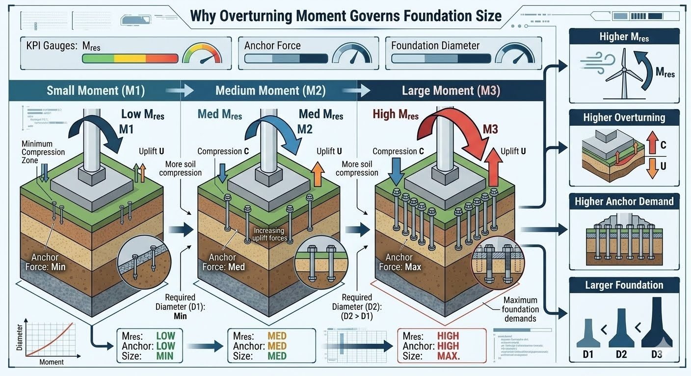
Discover how overturning moment drives anchor force, soil compression, and foundation diameter. Master sizing calculations following ACI 318 standards.
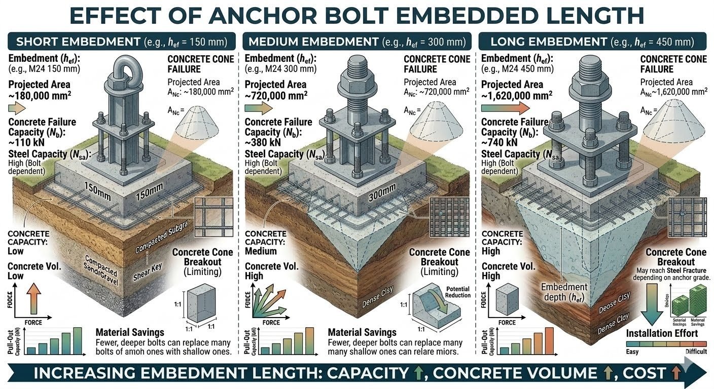
Compare short, medium, and long anchor bolt embedded lengths. Learn how embedment depth impacts concrete cone breakout capacity per ACI 318 standards.
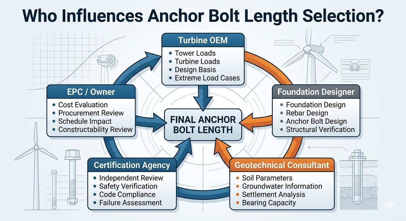
Discover how 5 key stakeholders determine wind turbine anchor bolt length, balancing OEM loads, geotechnical data, and structural codes.

Analyze the effect of concrete strength on foundation design comparing 25 MPa, 35 MPa, and 50 MPa grades. Optimize load capacity and size.
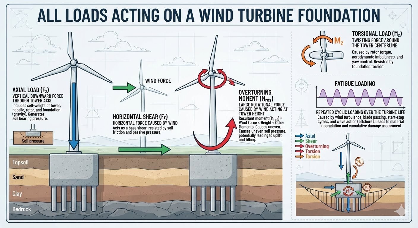
Master the 4 critical wind turbine foundation loads: axial, shear, overturning moment, and torsion. Ensure structural stability using ASME/API standards.
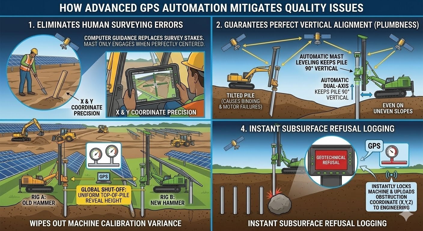
Deploy GPS pile installation to eliminate 4 critical field errors. Discover how automated dual-axis leveling prevents downstream tracker binding.

Master Earthwork Optimization for BESS projects. Learn site grading, drainage, and cost-saving strategies to ensure structural stability for battery energy storage.