Master rock anchored wind turbine foundation design, anchor socket bond strength, and bedrock uplift checks per ASCE standards.
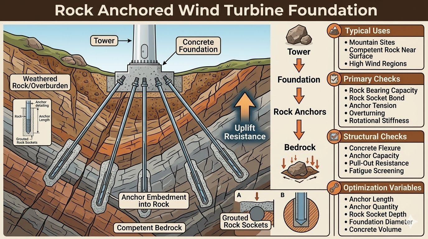
Master rock anchored wind turbine foundation design, anchor socket bond strength, and bedrock uplift checks per ASCE standards.
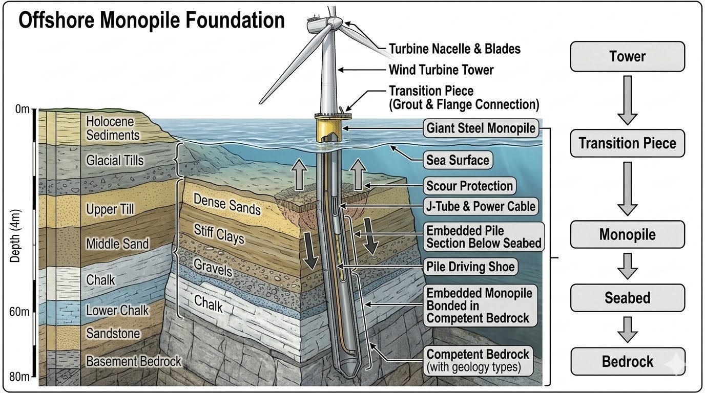
Master offshore monopile foundation design with expert insights on load paths, transition pieces, seabed geology, and bedrock embedding depths.
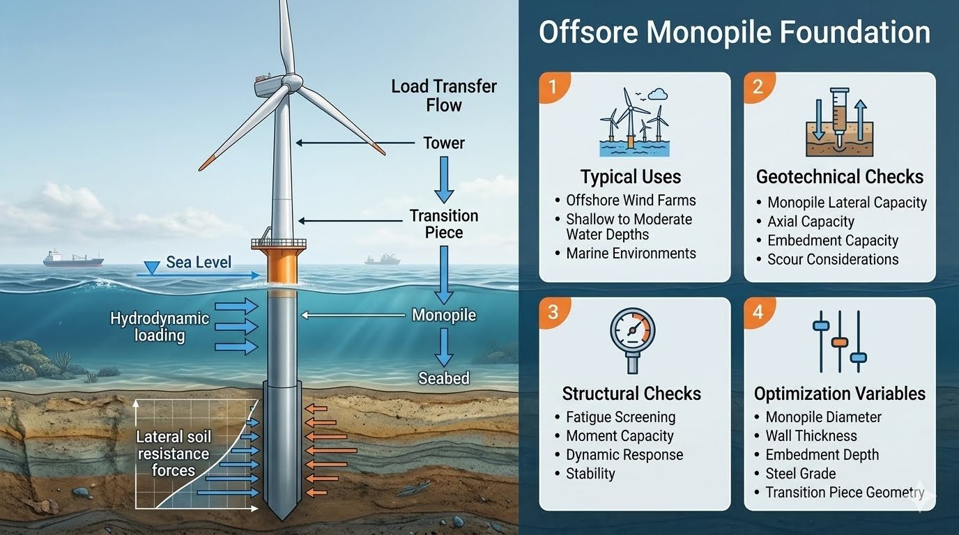
Master offshore monopile foundation design, load transfer mechanics, geotechnical checks, and structural optimization for marine wind farms per standards.
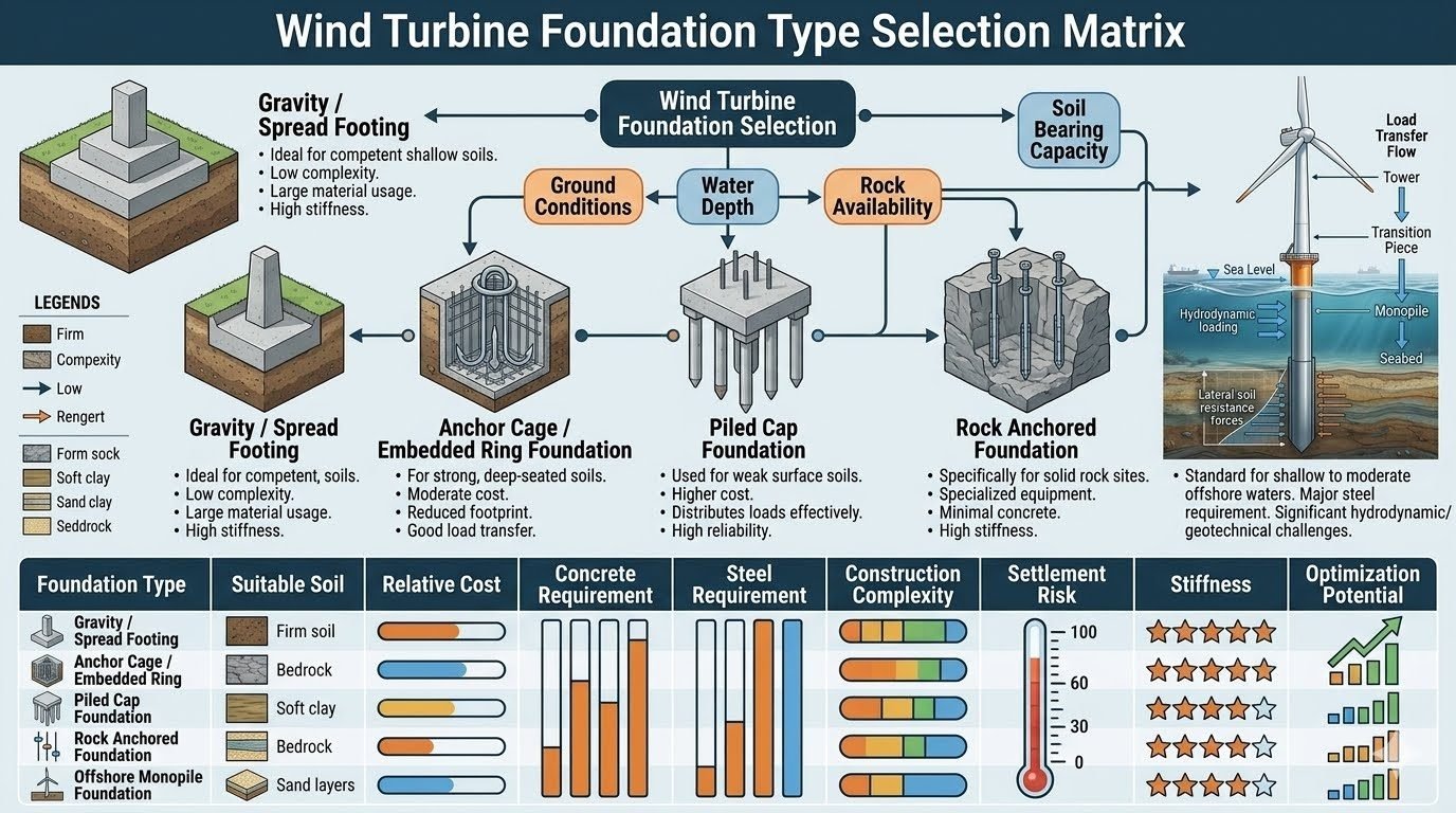
Master the wind turbine foundation selection matrix with this engineering guide comparing 5 foundation types, soil criteria, costs, and design standards.
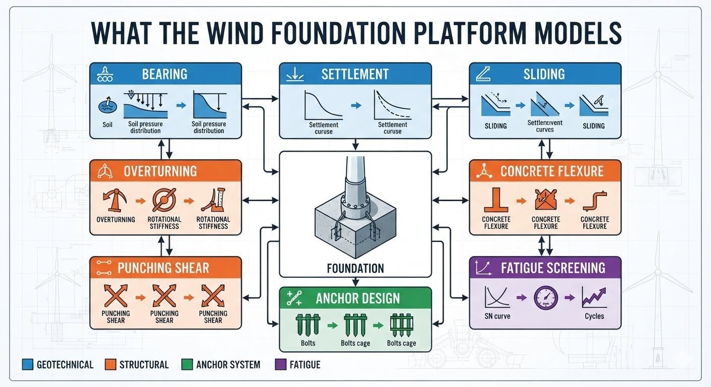
Explore our advanced wind turbine foundation design platform. Master 9 critical geotechnical, structural, and anchor engineering analysis modules today.
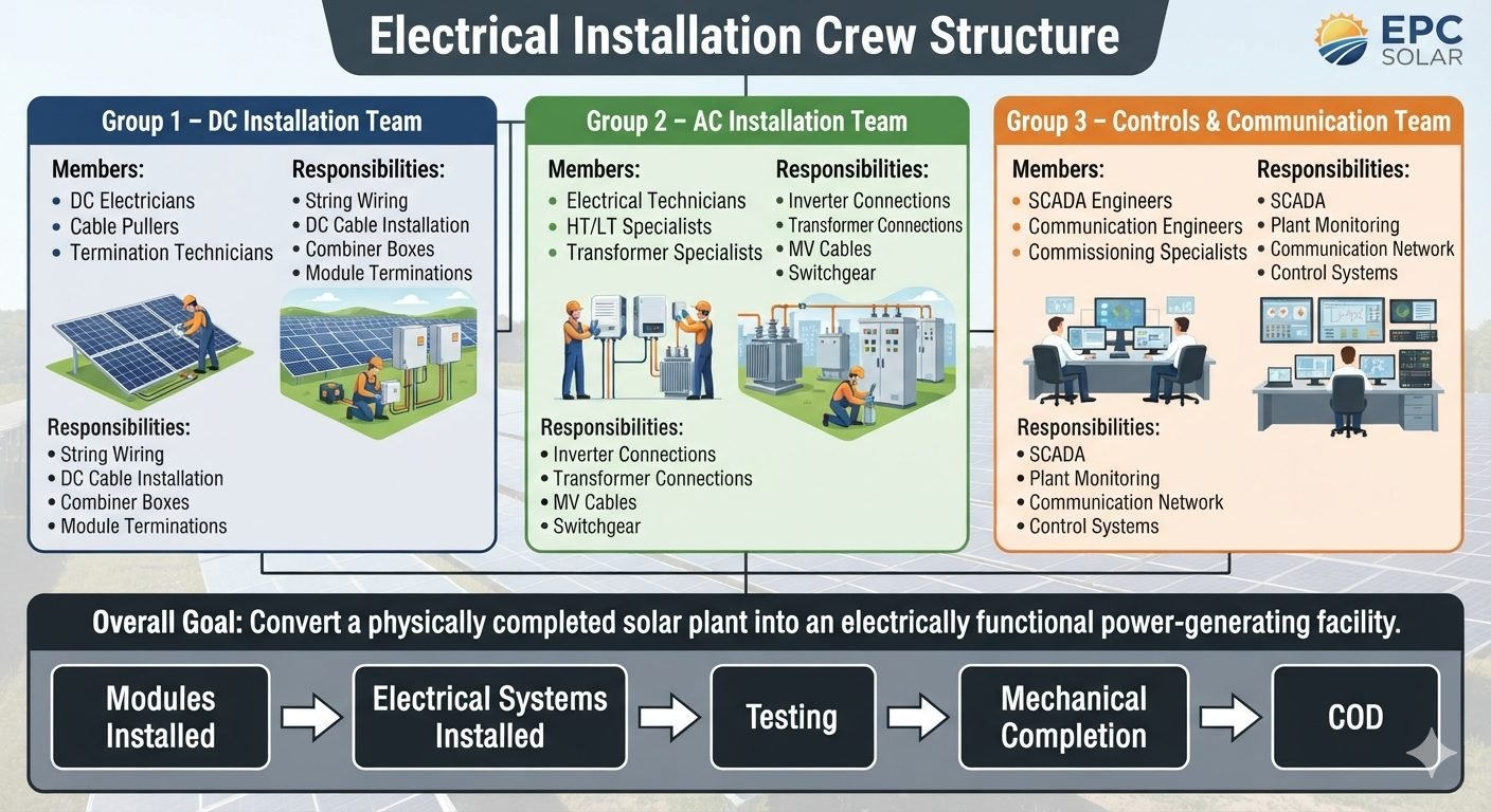
Master solar plant electrical installation with specialized DC, AC, and controls teams. Follow step-by-step milestones to commercial operation date.
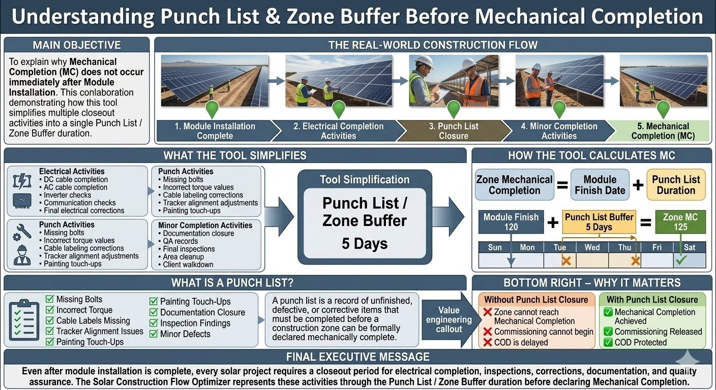
Discover why Mechanical Completion requires electrical work and punch list closure after module installation. Protect your COD with our engineering guide.
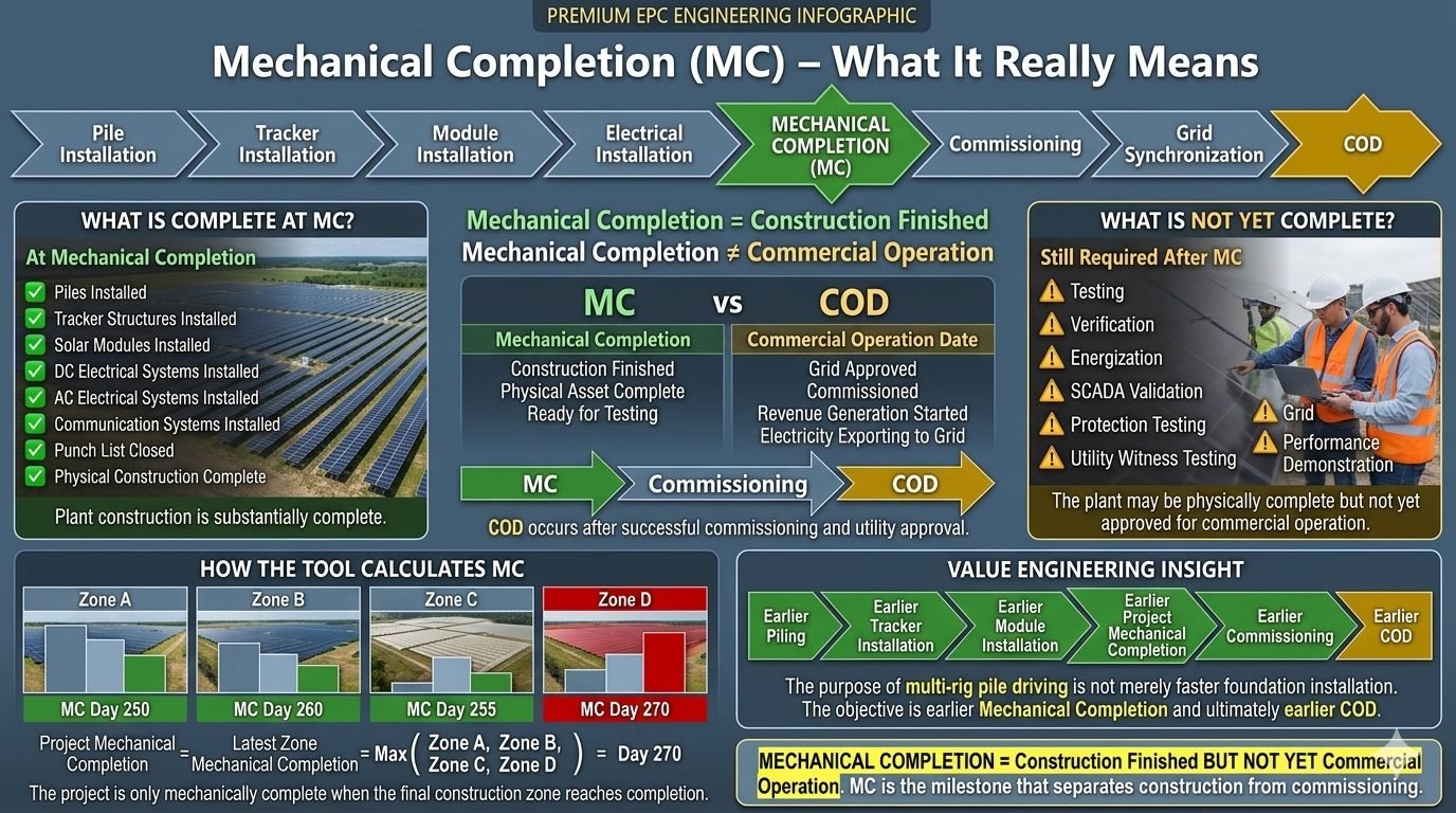
Discover how Mechanical Completion marks solar construction finish before commissioning. Learn zone calculations, ASME standards, and COD acceleration.
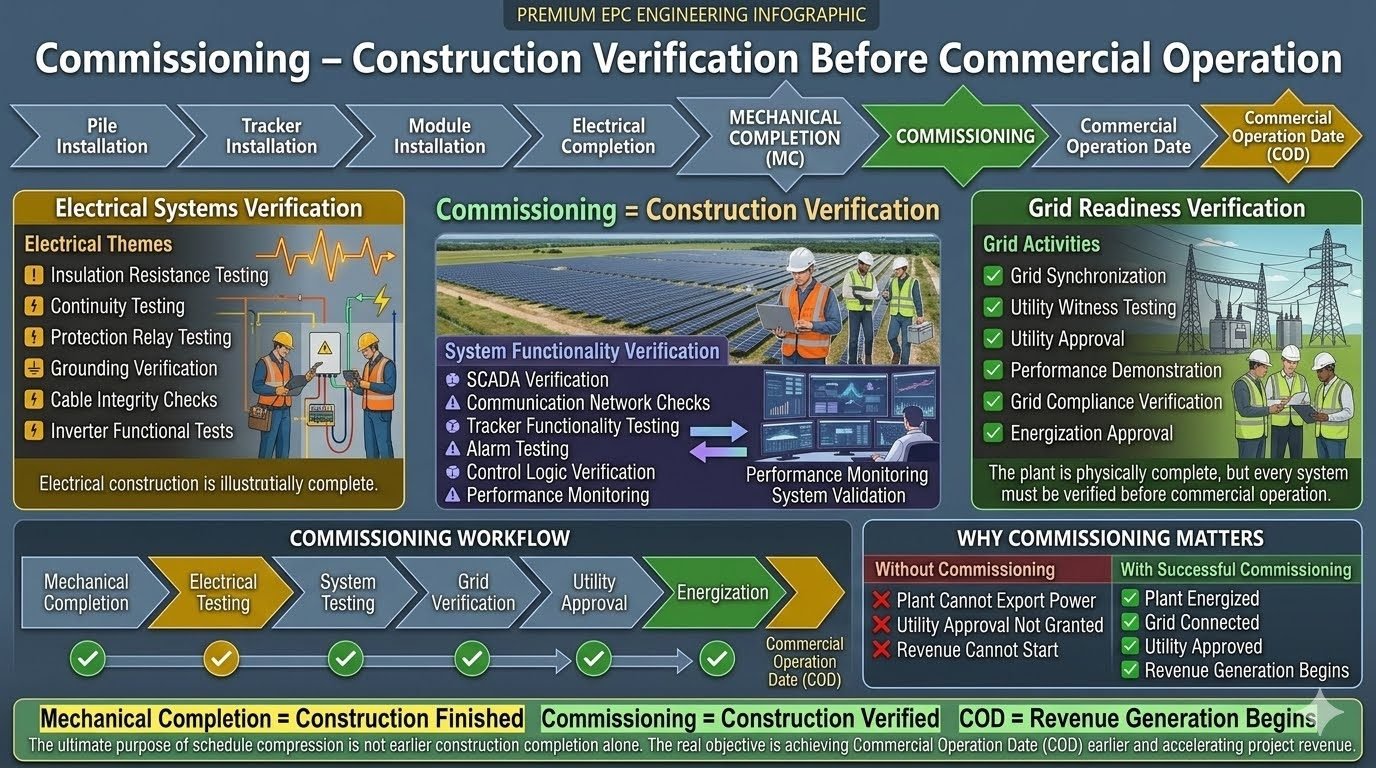
Master solar power plant commissioning with this engineering guide. Learn electrical testing, grid readiness, and utility approval steps before COD.
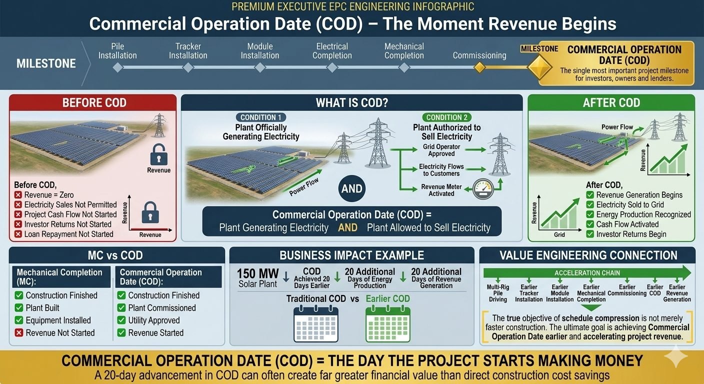
Discover how achieving an earlier Commercial Operation Date accelerates revenue and maximizes solar project returns. Learn the key milestones inside.
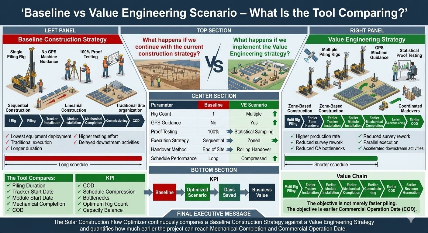
Compare baseline piling versus a Value Engineering Strategy using GPS guidance and zone-based construction to accelerate COD and boost project returns.
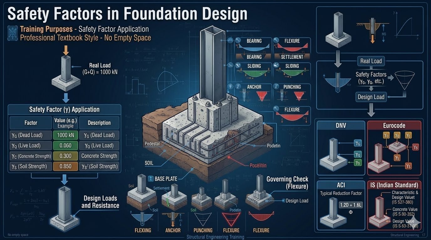
Master foundation design safety factors using gamma multipliers, load combinations, and geotechnical code standards for safe structural engineering.