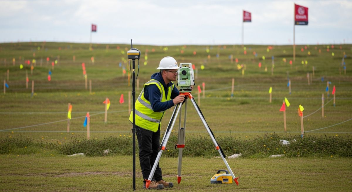
Topographical Surveys for Data Centre Projects: A Technical Guide
In my two decades of managing large-scale industrial infrastructure, I have learned that the success of a data centre project is dictated long before the first foundation is poured. A rigorous topographical survey is not merely a map; it is the foundational data set that informs every subsequent decision regarding drainage, utility routing, and structural load distribution.
Data centres require extreme precision due to the sensitivity of the equipment and the massive scale of the cooling infrastructure. When we fail to map existing underground utilities or miscalculate surface gradients, the resulting rework can cost millions in project delays. This guide breaks down the technical requirements for executing these surveys to meet the stringent demands of modern hyperscale facilities.
Key Takeaways for Engineering Teams:
- Establish a site-specific control network tied to national geodetic datums.
- Integrate GPR and electromagnetic induction for comprehensive utility identification.
- Ensure surface models meet a minimum 10mm vertical accuracy for slab-on-grade planning.
- Map floodplain boundaries using historical data and local hydrological modeling standards.
Technical Requirements for Topographical Surveys for Data Centre Projects
Topographical Surveys for Data Centre Projects: These surveys provide the high-fidelity spatial data required to align civil, structural, and mechanical designs with the physical reality of the site, ensuring compliance with ISO 19650 BIM standards.
When I approach a new site, the first step is establishing a robust primary control network. For data centres, we cannot rely on local site markers alone; we must tie into the national geodetic grid to ensure that the site coordinate system remains consistent throughout the multi-year construction lifecycle. Any drift in the coordinate system can lead to catastrophic misalignments between the underground cooling pipe racks and the building penetrations.
Surface Modeling and Accuracy Standards
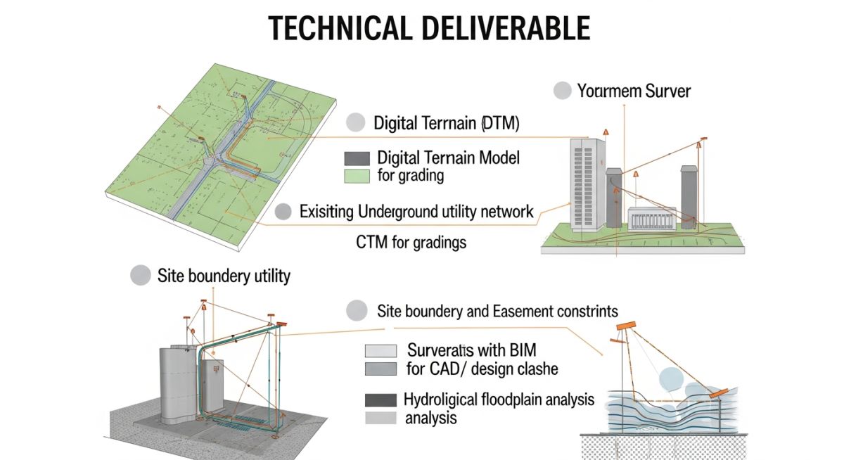
The surface model is the backbone of the site grading plan. For a data centre, we typically require a grid density of 5 meters by 5 meters, with breaklines captured at every change in slope, curb, or pavement edge. The vertical accuracy must be within 10mm to ensure that the massive concrete slabs, which often house thousands of server racks, are perfectly level.
Field Warning: The Impact of Inaccurate Data
In my experience, relying on legacy survey data for brownfield data centre expansions is a common failure point. Always perform a fresh, high-density scan. If the existing site model is off by even 50mm, the gravity-fed drainage systems for the cooling plant will fail to meet the required slope, leading to standing water and potential foundation settlement issues.
Utility Identification and Mapping
Utility mapping is the most critical phase for risk mitigation. We utilize a combination of Ground Penetrating Radar (GPR) and electromagnetic induction to locate buried services. Every utility line must be tagged with its depth, material, and diameter. In the context of ASCE 38-02, we aim for Quality Level A, which involves exposing the utility through vacuum excavation to verify its exact location.
The calculation for utility clearance is straightforward but often overlooked. If a high-voltage power line is identified, we must maintain a minimum clearance of 3 meters from any proposed excavation. We calculate the “zone of influence” for each utility to ensure that our heavy equipment movement does not cause vibration-induced damage to aging underground infrastructure.
Surveying Methodology Trade-offs: Evaluating the technical benefits and operational constraints of high-precision topographical data acquisition for large-scale industrial developments.
Advantages
- Reduces costly field rework by identifying underground conflicts early.
- Provides a precise digital twin for BIM integration and clash detection.
- Ensures compliance with local drainage and environmental flood regulations.
- Optimizes earthwork volumes, reducing site preparation and haulage costs.
- Enhances safety by mapping high-voltage and hazardous utility lines.
Disadvantages
- High initial cost for high-density LiDAR and GPR equipment.
- Requires significant time for data processing and model validation.
- Susceptible to signal interference in dense urban or industrial environments.
- Requires specialized expertise to interpret complex utility data sets.
- Potential for data obsolescence if site conditions change rapidly.
Topographical Survey Implementation: Applying high-precision spatial data across diverse engineering sectors to solve complex site development challenges.
Hyperscale Data Centre Site Grading
High-precision surveys are used to establish the precise finished floor elevation (FFE) for massive server halls. This ensures that the slab-on-grade design accounts for regional soil bearing capacity and long-term settlement, preventing structural cracking in the sensitive server environment.
Cooling Infrastructure Pipe Rack Routing
Topographical data allows engineers to design gravity-fed cooling water return lines with the exact required slope. By mapping existing underground obstructions, we can optimize the pipe rack path to minimize bends and pressure drops, significantly improving the overall cooling efficiency of the facility.
Floodplain Mitigation and Drainage Design
For sites located near water bodies, detailed surface models are used to run hydrological simulations. This ensures that the data centre’s perimeter drainage system can handle a 100-year storm event, protecting critical power and cooling infrastructure from flood-related downtime.
When executing Topographical Surveys for Data Centre Projects, the precision of the data directly dictates the viability of the site’s civil design. Data centres require massive, perfectly level concrete slabs to support heavy server racks and cooling infrastructure, meaning even minor elevation errors can lead to significant structural rework or drainage failures. My experience dictates that we must categorize survey data based on the specific project phase, ranging from initial feasibility studies to final construction-grade as-builts.
The following table outlines the industry-standard tolerances I typically enforce for high-stakes data centre developments. These values align with RICS and ASCE guidelines for precision site engineering. Note that these tolerances are cumulative; they account for both instrument error and environmental variables such as thermal expansion of survey equipment during long-duration site visits.
| Survey Classification | Horizontal Tolerance | Vertical Tolerance | Primary Application |
|---|---|---|---|
| Feasibility/Concept | +/- 100mm | +/- 50mm | Site selection and massing |
| Detailed Design | +/- 25mm | +/- 10mm | Drainage and road alignment |
| Construction/Setting Out | +/- 5mm | +/- 3mm | Foundation and slab pouring |
Adhering to these strict thresholds ensures that the digital twin of the site remains an accurate representation of reality. Failure to maintain these standards during the initial survey phase often results in “clash detection” issues during the BIM coordination process, which can delay project timelines by weeks.
In my two decades of managing large-scale infrastructure, I have found that the complexity of Topographical Surveys for Data Centre Projects often stems from the integration of disparate data types. We are not just measuring ground levels; we are mapping a complex web of underground utilities, environmental constraints, and existing structural footprints that must coexist with the new facility.
The matrix below serves as a technical reference for the various entities and standards involved in the survey lifecycle. By cross-referencing these parameters, engineers can ensure that every survey deliverable meets the rigorous requirements of modern data centre design, including compliance with ISO 19650 for information management.
| Entity/Parameter | Standard/Code | Technical Impact |
|---|---|---|
| Geodetic Control | WGS84 / ETRS89 | Global coordinate consistency |
| Utility Detection | PAS 128 | Risk mitigation for excavation |
| Surface Modeling | TIN/DEM Standards | Earthworks volume calculation |
Using this matrix as a checklist during the procurement of survey services helps prevent the common pitfall of “data gaps,” where critical underground assets are missed during the initial site assessment. Always ensure your survey scope explicitly references these standards to maintain legal and technical accountability.
Topographical Surveys for Data Centre Projects require a systematic approach to verification. Before any design work commences, I personally review the survey data against this checklist to ensure that the site model is robust enough for high-precision engineering. These checkpoints are designed to catch errors before they propagate into the structural design phase.
Verification Checkpoints
- ✓ Control Network Integrity: Verify that at least three permanent site benchmarks have been established and cross-referenced with national grid systems.
- ✓ Utility Verification: Confirm that all underground utility records (GPR/EML) have been validated against physical site markings and local authority records.
- ✓ Surface Model Density: Ensure the TIN (Triangulated Irregular Network) density is sufficient to capture subtle drainage gradients, particularly around critical cooling plant areas.
- ✓ Boundary Alignment: Cross-check the legal site boundaries against the physical fence line and historical land registry data to avoid encroachment issues.
- ✓ Floodplain Data: Validate that the 1-in-100-year flood level data is current and accounts for climate change projections as per local environmental agency requirements.
If any of these items fail verification, the survey data must be rejected and re-processed. In my experience, attempting to “fix” poor survey data in the CAD environment is a recipe for disaster. Always demand raw field data logs if you suspect the accuracy of the delivered surface model. This level of rigor is the only way to guarantee the structural integrity of a modern, high-density data centre facility.
The Problem: Inaccurate Utility Mapping
During a recent hyperscale data centre project, the initial topographical survey failed to identify a legacy high-voltage cable buried beneath the proposed generator yard.
- Reliance on outdated utility records without GPR verification.
- Lack of site-specific utility tracing during the survey phase.
- Misinterpretation of surface features indicating potential underground conduits.
The Outcome: Successful Mitigation and Redesign
By implementing a secondary, targeted utility survey, we identified the cable and adjusted the site layout to maintain required clearance distances.
- Avoided a potential multi-million dollar utility relocation cost.
- Prevented a critical safety incident during the excavation phase.
- Maintained the project schedule by integrating the new data into the BIM model within 48 hours.
My recommendation for future projects is to mandate a “utility-first” approach in the survey scope. Never assume that existing records are complete; always verify with modern geophysical techniques to protect the project from unforeseen subsurface hazards.
Why is PAS 128 essential for data centre utility mapping?
PAS 128 provides a standardized framework for the detection, verification, and location of underground utilities. For data centres, where the density of power and fiber optic lines is extreme, this standard is non-negotiable.
- It defines four quality levels (QL-D to QL-A) for utility data, allowing engineers to assess the reliability of the information.
- It mandates the use of multiple detection methods, such as GPR and electromagnetic location, to minimize the risk of “ghost” utilities.
- It ensures that all utility data is captured in a format compatible with BIM, facilitating better clash detection during the design phase.
How does survey accuracy impact slab-on-grade design?
Data centre slabs require extreme flatness and levelness to support high-density server racks. If the topographical survey is inaccurate, the earthworks contractor may fail to achieve the required subgrade elevation, leading to uneven slab thickness.
- Inaccurate elevation data leads to incorrect concrete volume estimates, causing budget overruns.
- Poor subgrade preparation can lead to differential settlement, which is catastrophic for sensitive server equipment.
- High-precision surveys allow for the creation of a digital terrain model that guides automated grading equipment, ensuring the subgrade is perfectly prepared for the slab.
What is the role of floodplain mapping in site selection?
Floodplain mapping is a critical component of Topographical Surveys for Data Centre Projects because data centres are mission-critical facilities that must remain operational during extreme weather events.
- It identifies the 1-in-100-year and 1-in-1000-year flood zones, which dictates the minimum finished floor elevation (FFE) of the facility.
- It informs the design of site-wide drainage systems, including attenuation ponds and swales, to manage stormwater runoff.
- It is often a requirement for insurance and regulatory compliance, as data centres are high-value assets that require robust flood risk mitigation strategies.
How often should survey control be verified on-site?
In my experience, survey control should be verified at the start of every major construction phase and after any significant weather event that could disturb the benchmarks.
- Daily checks of the total station calibration are standard practice to ensure instrument accuracy.
- Weekly verification of site benchmarks against a known, stable reference point outside the construction zone is recommended.
- If the site is subject to heavy machinery movement, the risk of benchmark disturbance is high, necessitating more frequent checks to maintain the integrity of the site coordinate system.
What are the common errors in topographical surveys?
Common errors in Topographical Surveys for Data Centre Projects often arise from human error or inadequate equipment calibration, which can have cascading effects on the project.
- Misinterpretation of site features, such as mistaking a temporary stockpile for natural ground level.
- Failure to account for atmospheric conditions, which can affect the accuracy of laser-based measurements over long distances.
- Incomplete data capture, where areas of the site are obscured by vegetation or existing structures, leading to gaps in the surface model.
How do I integrate survey data into BIM workflows?
Integrating survey data into BIM requires a clear data exchange protocol, typically using formats like IFC or LandXML, to ensure compatibility between the survey software and the design platform.
- Ensure that the survey coordinate system is correctly mapped to the project’s shared coordinate system in the BIM environment.
- Clean the survey data to remove unnecessary points that can bloat the model and slow down performance.
- Use the survey data to create a high-fidelity terrain model that serves as the foundation for all site-related design elements, ensuring that the digital model accurately reflects the physical site conditions.
Complete Course on
Piping Engineering
Check Now
Key Features
- 125+ Hours Content
- 500+ Recorded Lectures
- 20+ Years Exp.
- Lifetime Access
Coverage
- Codes & Standards
- Layouts & Design
- Material Eng.
- Stress Analysis
