
How to Prepare an RFP for Topographical Surveys
In my two decades of piping and plant design, I have seen countless projects derailed by poor-quality site data. When you initiate an RFP for topographical surveys, you are not just buying a map; you are establishing the geometric foundation for your entire multi-million dollar facility. A vague scope leads to change orders, site clashes, and costly field rework during the piping installation phase.
I have learned that the difference between a successful project and a disaster often lies in the clarity of the technical specifications provided to the surveyor. This guide breaks down the essential components of a robust RFP, ensuring your survey team delivers data that meets the rigorous demands of modern industrial engineering.
Key Takeaways for RFP Success:
- Define the specific coordinate system and datum early to avoid transformation errors.
- Mandate clear accuracy requirements based on ASCE 38-02 standards.
- Specify deliverables in native CAD formats with standardized layer naming conventions.
- Include a mandatory site walk-through to identify hidden obstructions and site constraints.
Defining the RFP for Topographical Surveys Scope
Survey Scope Definition: The comprehensive identification of physical site features, underground utilities, and elevation data required to support engineering design and construction activities.
When I draft an RFP for topographical surveys, I prioritize the definition of the “Area of Interest” (AOI). It is not enough to simply provide a property boundary. You must explicitly state the buffer zones required for tie-ins, access roads, and potential future expansion. In brownfield projects, the scope must include existing pipe racks, structural foundations, and overhead power lines, as these are critical for clash detection in 3D modeling.
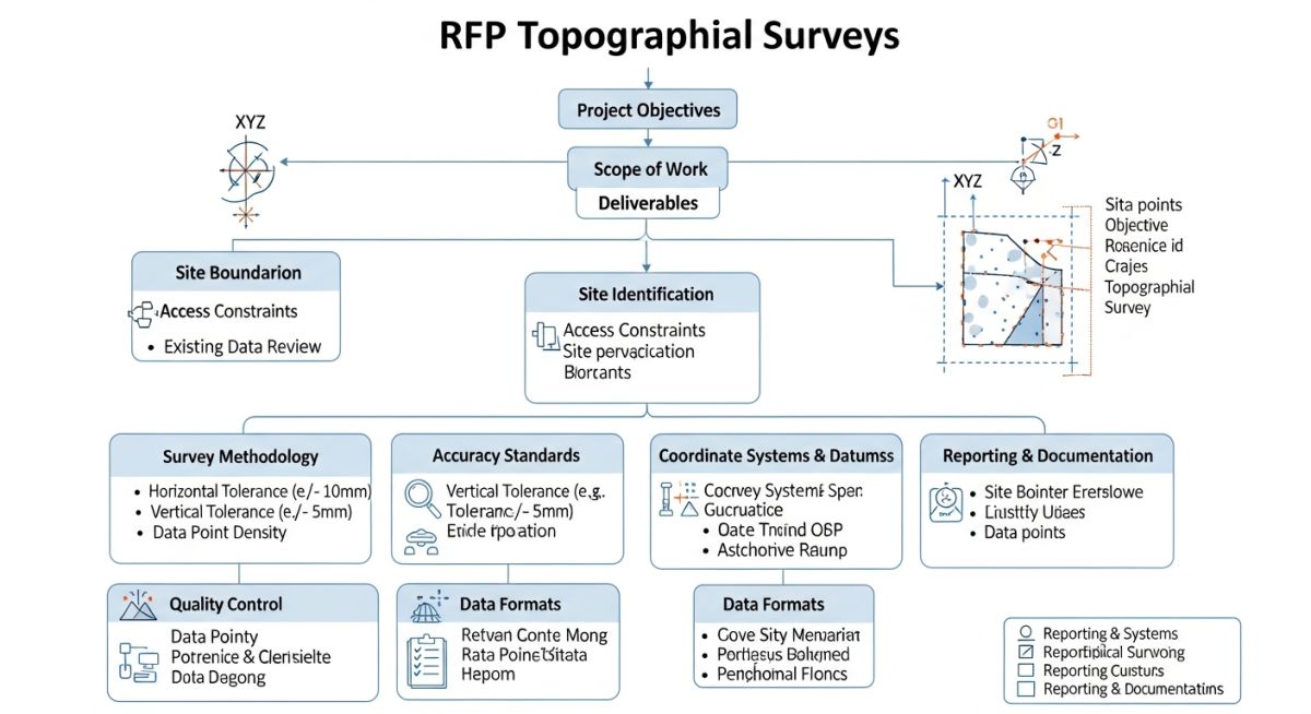
The technical requirements must reference NSPS standards. I always require the surveyor to provide a point cloud density that supports a minimum grid spacing of 5 meters for general terrain, but I tighten this to 1 meter for areas surrounding critical equipment foundations. This density is vital for calculating cut-and-fill volumes accurately.
Field Warning: The “Hidden” Cost of Incomplete Scope
Failure to specify the inclusion of “Subsurface Utility Engineering” (SUE) levels in your RFP is a common oversight. If the surveyor only maps surface features, you will inevitably encounter unknown underground piping during excavation. Always mandate SUE Quality Level B or A for critical work zones to mitigate risk.
Coordinate systems are the backbone of your project. I insist on using a project-specific local coordinate system that is tied to a known geodetic datum, such as NAD83 or WGS84. Never allow the surveyor to use an arbitrary “assumed” coordinate system unless the project is completely isolated from existing infrastructure. If you are working on a plant expansion, the survey must match the existing plant grid exactly to ensure seamless integration of new piping runs.
Finally, the accuracy requirements must be quantified. I typically specify a vertical accuracy of 0.05 feet for hard surfaces and 0.10 feet for soft terrain. These tolerances are non-negotiable when designing gravity-fed drainage systems or high-precision equipment pads. By embedding these specific metrics into the RFP, you provide the surveyor with a clear benchmark for their QA/QC processes.
Survey RFP Strategic Impact: The systematic evaluation of procurement benefits versus potential operational risks inherent in externalizing site data collection.
Advantages
- Risk Mitigation: Clearly defined scope reduces the likelihood of change orders during the construction phase.
- Design Efficiency: High-density point clouds allow for faster 3D model development and clash detection.
- Standardization: Enforcing specific CAD layers ensures data compatibility with internal engineering software.
- Legal Protection: A formal, signed RFP serves as a contractual baseline for liability and performance expectations.
Disadvantages
- Upfront Time Investment: Developing a detailed technical RFP requires significant engineering hours before the project starts.
- Procurement Complexity: Rigid specifications may limit the pool of qualified bidders who can meet strict accuracy requirements.
- Potential for Over-Specification: Over-defining requirements can lead to inflated survey costs for data that may not be necessary.
- Coordination Overhead: Managing the QA/QC of external survey data requires dedicated internal oversight and validation.
Topographical Survey Implementation: The application of precise spatial data across diverse industrial sectors to facilitate safe and efficient infrastructure development.
Brownfield Plant Expansion
In brownfield environments, precise topographical data is essential for integrating new pipe racks with existing, often undocumented, infrastructure. By mandating a survey that captures existing tie-in points and structural elevations, engineers can perform accurate stress analysis and ensure that new piping layouts do not violate existing clearance requirements.
Greenfield Site Development
For greenfield projects, the survey RFP focuses on large-scale terrain modeling and drainage analysis. Accurate contour data is required to optimize earthwork volumes, minimizing the need for imported fill or excessive excavation, which significantly impacts the overall project budget and environmental footprint.
Underground Utility Mapping
When upgrading aging facilities, the RFP must prioritize SUE (Subsurface Utility Engineering) to map existing electrical conduits, fiber optics, and process piping. This prevents catastrophic utility strikes during excavation and allows for the safe routing of new underground services in congested plant corridors.
When drafting an RFP for topographical surveys, defining the required accuracy class is the most critical step to prevent cost overruns and rework. In my experience, engineers often default to generic “survey grade” requirements without specifying the underlying ASCE or FGDC standards. The table below outlines the typical accuracy thresholds required for various stages of piping and site development projects, ranging from preliminary feasibility studies to high-precision construction layout.
Selecting the correct class depends entirely on the project phase. For early-stage routing, lower-density data is acceptable, but for brownfield tie-ins or underground utility mapping, you must mandate higher vertical and horizontal precision. Always ensure your RFP explicitly references the NSPS standards to provide a legal and technical baseline for the surveyor’s performance.
| Survey Application | Horizontal Tolerance | Vertical Tolerance | Standard Reference |
|---|---|---|---|
| Preliminary Site Routing | 0.50 ft | 0.20 ft | ASCE 38-02 |
| Detailed Design/Piping | 0.10 ft | 0.05 ft | ALTA/NSPS |
| Underground Utility Mapping | 0.05 ft | 0.02 ft | ASCE 38-02 (QL-A) |
Note that these tolerances are cumulative. If your project involves high-pressure gas lines or sensitive instrumentation, I recommend tightening these requirements further to account for potential settlement or construction-induced ground movement.
Managing the technical data flow between the surveyor and the engineering team requires a standardized approach to coordinate systems and file formats. In my years of project management, I have seen countless hours lost due to mismatched coordinate systems or incompatible CAD layers. This matrix serves as a foundational guide for defining the technical requirements within your RFP, ensuring that the data received is immediately usable by your design team.
By enforcing these specific standards, you eliminate the ambiguity that often leads to “data translation” errors. Whether you are working in a local site grid or a global geodetic system, the requirements must be clearly stated to ensure the surveyor provides the correct metadata, projection files, and point cloud density required for modern BIM and 3D modeling workflows.
| Entity/Parameter | Technical Specification | Standard/Reference |
|---|---|---|
| Coordinate System | NAD83 / UTM Zone | NGS / FGDC |
| Vertical Datum | NAVD88 | NOAA / NGS |
| CAD Format | DWG (Civil 3D) | ISO 13567 |
| Point Cloud | LAS / E57 | ASTM E2807 |
Always verify that the surveyor has the capability to export in the specific version of your design software. A common pitfall is requesting a format that the surveyor’s software cannot natively support, leading to loss of data integrity during conversion.
Before finalizing your RFP for topographical surveys, use this checklist to ensure all technical and administrative bases are covered. A well-structured RFP is the first line of defense against project delays and budget overruns. In my experience, the most successful projects are those where the surveyor understands the site constraints and the engineering team’s specific data needs before they ever step foot on the property.
-
Coordinate System Definition: Have you specified the exact projection, datum, and epoch (e.g., NAD83 2011) to avoid grid-to-ground conversion errors? -
Utility Locating Scope: Does the RFP explicitly state the requirement for ASCE 38-02 Quality Level A (daylighting) versus Quality Level D (records research)? -
Deliverable Format: Are the CAD layering standards, point cloud density, and metadata requirements clearly defined for your BIM/3D modeling team? -
QA/QC Protocols: Have you mandated a field verification report and a signed/sealed survey document from a licensed Professional Land Surveyor (PLS)? -
Site Access & Safety: Have you provided site-specific safety requirements, including PPE, permit-to-work, and hazardous area (HAZOP) access protocols?
By validating these items, you ensure that the surveyor is not just providing “data,” but providing actionable engineering intelligence. Always require a pre-survey site walk-through with the lead surveyor to discuss these points in person, as this often uncovers site-specific challenges that are not apparent on paper.
The Problem: Incomplete Underground Utility Mapping
A major refinery expansion project faced significant delays when the topographical survey failed to accurately map existing underground fiber-optic lines, leading to a major line strike during excavation.
- Ambiguous RFP language regarding utility locating standards.
- Reliance on outdated “as-built” drawings without field verification.
- Lack of GPR (Ground Penetrating Radar) requirements in the scope.
- Failure to mandate ASCE 38-02 Quality Level A for critical zones.
The Outcome: Implementation of Rigorous Survey Standards
By revising the RFP to mandate strict adherence to ASCE 38-02 and requiring GPR for all excavation zones, the project team successfully mitigated future risks and improved site safety.
- Zero utility strikes during the subsequent 18 months of construction.
- 15% reduction in excavation rework costs due to accurate data.
- Improved coordination between civil, piping, and electrical disciplines.
- Full compliance with site safety and insurance requirements.
My recommendation is to always treat the topographical survey as a high-risk activity. Never assume that a “standard” survey will cover the complexities of a brownfield industrial site; always define the scope with the assumption that the subsurface is unknown until proven otherwise.
Frequently Asked Engineering Questions
What is the difference between ASCE 38-02 Quality Levels?
- Level D: Information from existing records and verbal accounts.
- Level C: Information from surface features and visual inspection.
- Level B: Information from surface geophysical methods (GPR, EM).
- Level A: Information from physical exposure (daylighting) for precise location.
Why is the coordinate system epoch important?
- Specifying an epoch (e.g., 2011.00) ensures all data is referenced to the same temporal baseline.
- Failure to define the epoch leads to “coordinate drift” when merging data from different survey campaigns.
- Always consult with the National Geodetic Survey for the most current epoch recommendations for your region.
How do I define deliverables for 3D modeling?
- Request a registered point cloud in a standard format like LAS or E57.
- Define the required point density (e.g., points per square meter) based on the level of detail needed.
- Ensure the surveyor provides a metadata report detailing the registration accuracy and control point residuals.
What are the common pitfalls in RFP scope?
- Always provide a clear site map showing the exact boundary of the required survey.
- Include requirements for off-site tie-ins, such as existing road centerlines or utility manholes.
- Specify the frequency of cross-sections or spot elevations to avoid gaps in the terrain model.
How do I ensure QA/QC in the RFP?
- Require the surveyor to submit a field verification report comparing their data to known benchmarks.
- Mandate that all drawings be signed and sealed by a licensed Professional Land Surveyor (PLS).
- Include a provision for independent third-party verification if the project involves high-risk infrastructure.
Should I include safety requirements in the RFP?
- Specify the need for site-specific safety orientations and permit-to-work systems.
- Define requirements for specialized equipment, such as intrinsically safe devices for hazardous areas.
- Ensure the surveyor’s insurance coverage meets the project’s minimum liability requirements.
Complete Course on
Piping Engineering
Check Now
Key Features
- 125+ Hours Content
- 500+ Recorded Lectures
- 20+ Years Exp.
- Lifetime Access
Coverage
- Codes & Standards
- Layouts & Design
- Material Eng.
- Stress Analysis

📚 Recommended Resources: Topographical Surveys
Read these Guides
- 📄 Geotechnical and Topographical Surveys: A Complete Guide for Engineers
- 📄 Topographical Survey Explained: Essential Engineering Site Data and Deliverables
- 📄 Understanding DTM, DEM and TIN Surface Models for Engineering Projects
- 📄 What is a 3D Point Cloud? Tools, Features & Engineering Applications (2026)