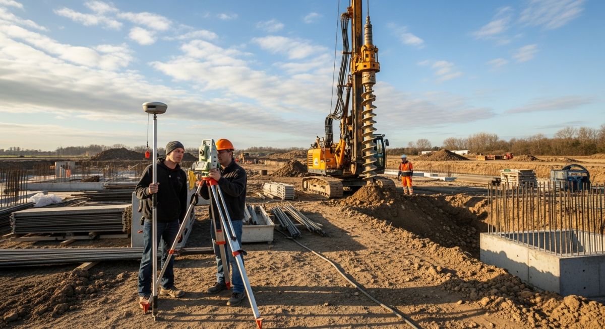
Geotechnical and Topographical Surveys: A Complete Engineering Guide
In my two decades of experience managing large-scale piping and infrastructure projects, I have learned that the most expensive failures rarely occur during construction—they occur during the planning phase due to inadequate site data. Whether you are routing a high-pressure cross-country pipeline or designing a heavy-duty pipe rack foundation, the integration of geotechnical and topographical surveys is non-negotiable.
Topographical surveys define the “where” by mapping the physical landscape, while geotechnical investigations define the “what” by analyzing the soil’s mechanical properties. Together, they form the bedrock of your FEED (Front-End Engineering Design) package. Ignoring the nuances of soil shear strength or elevation gradients often leads to catastrophic settlement, drainage failures, or costly field re-routing.
Key Takeaways for Project Success:
- Early integration of survey data reduces contingency budgets by up to 20%.
- Geotechnical reports must be correlated with site-specific seismic hazard maps.
- Topographical data is essential for accurate hydraulic modeling and erosion control.
- Always verify survey datum consistency across different project phases.
Technical Analysis of Geotechnical and Topographical Surveys
Site Data Integration: Geotechnical and topographical surveys serve as the primary inputs for structural load-bearing calculations and site grading optimization, governed by ASCE 7 and ASTM D420.
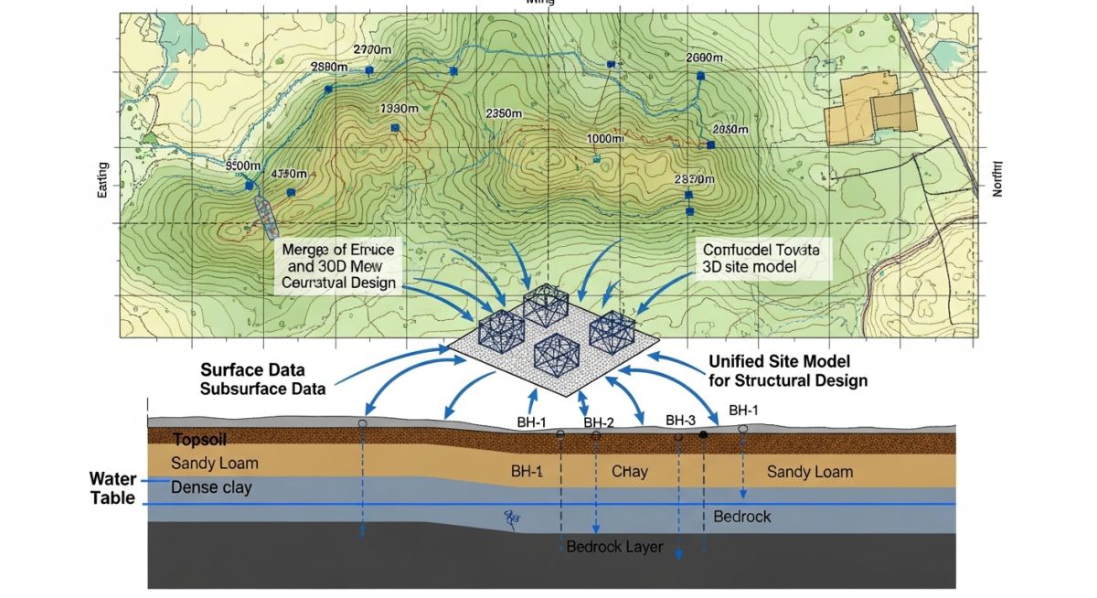
When I approach a new site, I treat the geotechnical report as the “DNA” of the project. The ASTM D420 standard guides the investigation of soil and rock for engineering purposes. We look specifically at the Standard Penetration Test (SPT) N-values to determine the allowable bearing pressure (q_a). If the N-value is low, we must account for potential consolidation settlement, which can induce secondary stresses in rigid piping systems.
The topographical survey, conversely, provides the Digital Elevation Model (DEM). In my experience, the most common error is failing to reconcile the survey datum with the plant coordinate system. A 50mm discrepancy in elevation can render a gravity-flow drainage design useless or cause significant misalignment in pipe rack elevations.
Field Warning: Subsurface Variability
Never assume soil homogeneity across a large site. I have seen projects where a 50-meter shift in foundation location moved the structure from competent bedrock to loose, saturated silt. Always perform localized borings at every major equipment foundation point, not just a general site-wide grid.
For foundation design, we utilize the Terzaghi bearing capacity equation. The ultimate bearing capacity (q_u) is calculated as: q_u = cNc + qNq + 0.5 * gamma * B * Ngamma. Here, ‘c’ is cohesion, ‘gamma’ is the unit weight of soil, and ‘B’ is the foundation width. The geotechnical survey provides the ‘c’ and ‘phi’ (angle of internal friction) values that dictate these variables. If your survey is inaccurate, your foundation size will be either dangerously undersized or economically wasteful.
Furthermore, topographical surveys allow us to calculate cut-and-fill volumes using the Average End Area method. By comparing the existing ground levels to the proposed finished grade, we optimize earthworks to minimize soil import or export. This is a critical cost-driver in industrial construction where moving thousands of cubic meters of soil can inflate the budget by millions.
Survey Implementation Trade-offs: Comprehensive site investigations offer significant risk mitigation at the cost of initial capital expenditure and project schedule duration.
Advantages
- Eliminates “unknown subsurface conditions” claims during construction.
- Optimizes foundation sizing, reducing concrete and reinforcement steel volume.
- Ensures precise alignment for long-distance piping and gravity sewers.
- Provides legal documentation for environmental and seismic compliance.
- Facilitates accurate earthwork volume estimation for procurement.
Disadvantages
- High upfront cost for deep-boring and high-precision laser scanning.
- Requires significant lead time, potentially delaying the design start.
- Risk of “data paralysis” if survey scope is poorly defined.
- Potential for site disturbance in environmentally sensitive areas.
- Requires specialized expertise to interpret complex geotechnical data.
Engineering Survey Utility: Precise site data is applied across diverse industrial sectors to ensure structural integrity and operational efficiency in challenging environments.
High-Pressure Pipeline Routing
Topographical surveys are used to identify optimal terrain profiles that minimize pipe bending and stress concentrations. Geotechnical data ensures that trenching operations avoid unstable soil strata that could lead to pipeline buoyancy or differential settlement.
Heavy Industrial Equipment Foundations
For rotating equipment like compressors or turbines, geotechnical surveys determine the dynamic soil response. This data is used to design massive concrete blocks that prevent vibration transmission and ensure long-term alignment of mechanical shafts.
Brownfield Site Redevelopment
In existing plants, topographical surveys map the complex web of underground utilities. Geotechnical investigations then assess the impact of new, heavier loads on the existing soil structure, which may have been altered by decades of industrial activity.
Coastal Infrastructure Protection
Geotechnical surveys in coastal zones evaluate soil liquefaction potential during seismic events. Topographical data informs the design of sea walls and drainage systems to prevent flooding and erosion, ensuring the facility remains operational during extreme weather.
In my two decades of field experience, I have observed that engineers often conflate these two distinct disciplines, leading to significant budget overruns during the earthworks phase. While topographical surveys define the “where” and “how much” of the surface, geotechnical surveys define the “what” and “how strong” of the subsurface. Understanding the specific data parameters for each is critical for accurate site preparation and foundation selection.
The following table outlines the primary data inputs and output metrics required for standard civil infrastructure projects. These parameters are governed by ASTM D420 for geotechnical site characterization and various ASCE standards for land surveying. Utilizing these metrics ensures that your site model aligns with the actual physical constraints of the project site.
| Parameter | Topographical Survey | Geotechnical Survey |
|---|---|---|
| Primary Focus | Surface geometry and elevation | Subsurface soil and rock mechanics |
| Key Output | Contour maps and DTM | Borehole logs and soil profiles |
| Standard Reference | ALTA/NSPS Standards | ASTM D2487 / D2488 |
| Design Impact | Grading and drainage design | Foundation and settlement analysis |
By integrating these datasets into a unified BIM environment, you can effectively mitigate risks associated with unexpected soil conditions or drainage failures. Always ensure that the survey datum for both investigations is synchronized to prevent vertical alignment errors in your final design drawings.
Effective project management requires a clear understanding of the technical entities involved in site investigation. This matrix maps the core components of Geotechnical and Topographical Surveys to their respective engineering standards and physical parameters. By standardizing these inputs, we reduce the ambiguity that often plagues the transition from preliminary design to construction execution.
Each entity listed below represents a critical data point that must be verified during the site investigation phase. Failure to account for these specific parameters can lead to non-compliance with local building codes and potential structural failure in high-load environments. Refer to the linked standards to ensure your project documentation meets current industry requirements.
| Entity | Standard | Application |
|---|---|---|
| Standard Penetration Test | ASTM D1586 | Soil density and bearing capacity |
| Digital Terrain Model | ISO 19157 | Earthwork volume calculations |
| Atterberg Limits | ASTM D4318 | Soil plasticity and expansion potential |
| Geodetic Control | NGS Guidelines | Site coordinate system alignment |
This matrix serves as a foundational reference for project leads. When reviewing survey reports, ensure that every entity listed here is addressed, as missing data in these categories is a primary driver of change orders during the foundation installation phase.
Site verification is the final gate before moving into detailed design. In my experience, the most successful projects are those where the engineering team personally verifies the survey data against site conditions. Use this checklist to ensure your Geotechnical and Topographical Surveys are comprehensive and ready for structural application.
Pre-Design Verification Checklist
- Coordinate System Alignment: Verify that the topographical survey and geotechnical borehole locations share the same horizontal and vertical datum (e.g., NAVD88).
- Borehole Density: Ensure the number of boreholes meets ASCE requirements for the specific structure footprint and soil variability.
- Groundwater Monitoring: Confirm that seasonal high groundwater levels are documented, as these significantly impact excavation safety and foundation waterproofing.
- Utility Mapping: Cross-reference the topographical survey with existing utility records to prevent conflicts during geotechnical drilling or site clearing.
- Soil Classification: Validate that all soil samples have been classified per ASTM D2487 to determine appropriate bearing capacity values.
- Site Access Constraints: Document any physical barriers (e.g., overhead power lines, steep slopes) that might impede heavy equipment during the construction phase.
Always document the date of the survey and the equipment used. If the survey is older than two years, I strongly recommend a supplemental site visit to account for potential erosion, site modifications, or changes in local water tables that could render the original data obsolete.
The Problem: Inaccurate Subsurface Modeling
A mid-sized industrial facility project faced a major delay when the foundation design failed to account for a localized lens of highly compressible organic soil that was missed during the initial geotechnical investigation.
- Insufficient borehole spacing in the primary load-bearing zone.
- Failure to correlate topographical surface drainage patterns with subsurface soil saturation.
- Lack of communication between the survey team and the geotechnical engineer regarding site history.
- Over-reliance on historical data from adjacent properties rather than site-specific testing.
The Outcome: Corrective Action and Project Recovery
By implementing a targeted supplemental geotechnical survey and integrating the findings into a revised 3D site model, the team successfully redesigned the foundation system to mitigate settlement risks.
- Reduced potential long-term settlement by 40% through deep foundation adjustments.
- Avoided a total project shutdown by identifying the issue during the pre-construction phase.
- Established a new protocol for cross-disciplinary review of all survey deliverables.
- Improved site drainage design by incorporating the updated topographical data.
My recommendation for similar projects is to mandate a “Data Integration Workshop” where the surveyor and the geotechnical engineer review the site model together before the final design is signed off. This simple step prevents the disconnect between surface and subsurface data that often leads to these costly field failures.
Frequently Asked Engineering Questions
How often should site surveys be updated?
- Perform a site walk-through after any major weather event to check for erosion.
- Verify that no new underground utilities have been installed by third parties.
- Re-validate geotechnical data if the proposed building footprint has shifted by more than 5 meters.
What is the impact of groundwater on foundation design?
- Always request a piezometer installation to monitor long-term water table fluctuations.
- Account for hydrostatic uplift pressure in the design of basement slabs and deep foundations.
- Ensure that the geotechnical report includes chemical analysis of groundwater to check for sulfate content, which can degrade concrete foundations.
Can I use existing survey data from a neighboring site?
- Use neighboring data only to identify potential regional geological hazards.
- Never rely on external data for structural load calculations or foundation sizing.
- Always conduct at least one confirmatory borehole on your specific site to correlate with the neighboring data.
How do topographical surveys influence earthwork costs?
- High-resolution surveys reduce the risk of “unforeseen site conditions” claims from contractors.
- Accurate grading plans derived from these surveys prevent drainage issues that lead to long-term maintenance costs.
- Integration with BIM software allows for real-time volume optimization during the design phase.
What are the risks of ignoring geotechnical reports?
- Differential settlement can cause catastrophic cracking in building envelopes.
- Foundation failure can lead to total loss of the structure and endanger human life.
- Insurance premiums and legal defense costs for failed projects far exceed the cost of a thorough investigation.
How do I select a qualified survey firm?
- Request references from past projects that involved similar soil types or site constraints.
- Ensure the firm has the necessary equipment for the specific site, such as specialized drilling rigs for difficult terrain.
- Verify their quality control procedures and their ability to provide data in the required digital formats for your BIM workflow.
Complete Course on
Piping Engineering
Check Now
Key Features
- 125+ Hours Content
- 500+ Recorded Lectures
- 20+ Years Exp.
- Lifetime Access
Coverage
- Codes & Standards
- Layouts & Design
- Material Eng.
- Stress Analysis
