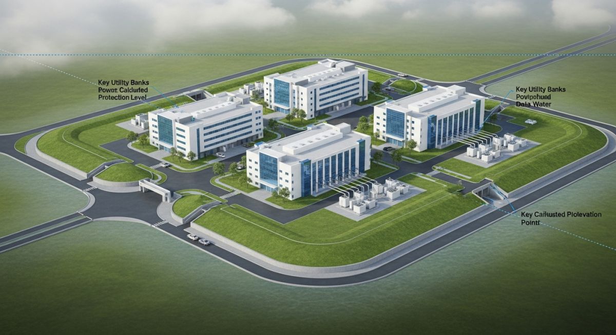
Flood Risk Assessment for Data Centres: Engineering Resilience
In my two decades of managing critical infrastructure projects, I have observed that the most overlooked threat to data centre availability is not power failure, but water ingress. A comprehensive Flood Risk Assessment for Data Centres is no longer a “check-the-box” regulatory requirement; it is a fundamental pillar of site selection and operational continuity. When we design for high-density compute environments, we must account for the intersection of localized surface water runoff, riverine flood plains, and the increasing volatility of climate-driven storm events.
This guide explores the technical rigour required to evaluate site hydrology. We will move beyond basic FEMA maps to analyze hydraulic modeling, drainage capacity, and the physical hardening of critical MEP assets. Protecting your facility requires a deep understanding of how water behaves under extreme stress, and how your site’s specific topography dictates the survival of your server halls.
Key Takeaways for Engineering Teams:
- Prioritize site selection based on 500-year flood event modeling rather than standard 100-year thresholds.
- Integrate climate change multipliers into all hydraulic drainage calculations to account for future precipitation intensity.
- Elevate critical MEP infrastructure, including backup generators and switchgear, at least 1.5 meters above the calculated base flood elevation.
- Implement redundant, gravity-fed drainage systems that operate independently of site power grids.
Technical Deep-Dive: Flood Risk Assessment for Data Centres
Flood Risk Assessment for Data Centres: A rigorous analytical framework that integrates hydrological modeling, topographical survey data, and climate-adjusted precipitation projections to define the structural protection requirements for mission-critical facilities.
When performing a Flood Risk Assessment for Data Centres, the engineering team must first establish the baseline hydrological profile. We utilize the Rational Method for small catchments, defined as Q = CiA, where Q is the peak discharge, C is the runoff coefficient, i is the rainfall intensity, and A is the drainage area. However, for modern data centres, this is merely the starting point. We must apply the Manning’s Equation for open channel flow to verify that site drainage infrastructure can handle peak flows without surcharging.
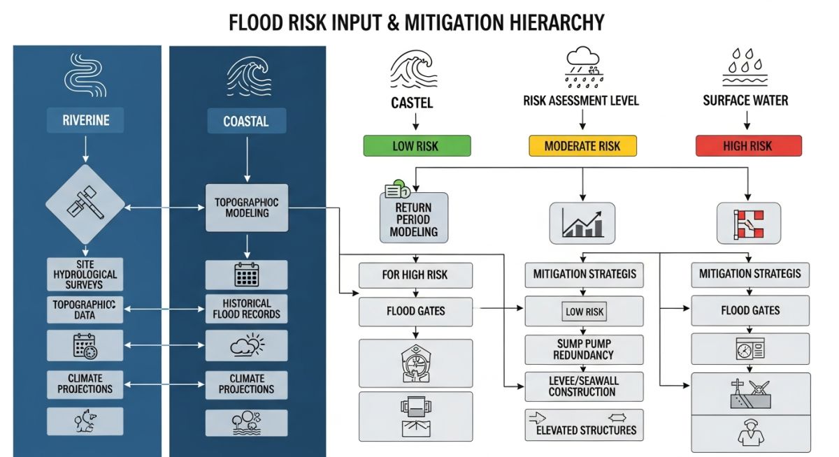
The calculation of return periods is critical. While local codes often mandate a 100-year flood protection level, I consistently recommend designing for the 500-year event. This involves analyzing historical gauge data and applying Gumbel distribution models to predict extreme value probabilities. We must also account for the “urban heat island” effect and increased impervious surfaces, which significantly alter the time of concentration for runoff.
Engineering Limitation Warning:
Standard municipal drainage systems are frequently undersized for current climate realities. Relying on existing public infrastructure capacity without performing an independent site-specific hydraulic study is a primary cause of facility flooding. Always verify the downstream capacity of the receiving water body or storm sewer network before finalizing site grading plans.
Climate change considerations require us to apply a “climate uplift factor” to all intensity-duration-frequency (IDF) curves. In my experience, adding a 20-30% buffer to projected rainfall intensity is a prudent engineering practice to ensure the facility remains operational through the end of its 25-year design life. We must also evaluate the risk of “flash flooding” caused by localized convective storms, which often bypass regional riverine flood models.
Structural hardening involves the strategic placement of critical assets. According to ASCE 24, Flood Resistant Design and Construction, we must ensure that all electrical switchgear, UPS systems, and cooling plant controls are located above the Base Flood Elevation (BFE). If site constraints prevent this, we implement “dry floodproofing” techniques, such as hydrostatic pressure-resistant walls and automated flood gates, designed to withstand the lateral forces of standing water.
Flood Resilience Strategy Evaluation: A comparative analysis of proactive engineering mitigation versus reactive site hardening, focusing on long-term operational availability and capital expenditure efficiency.
Engineering Advantages
- Significantly reduces the probability of catastrophic downtime during extreme weather events.
- Lowers long-term insurance premiums by demonstrating a proactive risk mitigation posture.
- Extends the operational lifespan of critical MEP assets by preventing moisture-related corrosion.
- Enhances facility reputation and client trust through verified uptime reliability.
- Provides a clear, defensible engineering basis for site selection and zoning approvals.
Engineering Disadvantages
- High initial capital expenditure for site grading and specialized flood-proofing systems.
- Increased complexity in site civil design and ongoing maintenance of drainage infrastructure.
- Potential for regulatory friction if site modifications impact adjacent property drainage.
- Requires continuous monitoring and updating of hydrological models as climate data evolves.
- Space constraints in urban environments may limit the implementation of large-scale detention basins.
Infrastructure Resilience Implementation: Practical deployment of flood mitigation technologies across diverse geographical and industrial contexts to ensure continuous service delivery.
Hyperscale Cloud Data Centres
These facilities require massive footprints, often necessitating development in low-lying areas near existing power grids. We apply advanced hydraulic modeling to create “island” site designs, where the entire facility is elevated on a structural podium above the 500-year flood plain, ensuring total isolation from surrounding surface water accumulation.
Urban Edge Computing Nodes
Located within dense city centers, these nodes face extreme risk from overwhelmed municipal storm sewers. We utilize internal, high-capacity sump pump systems with redundant power feeds and automated flood-gate barriers at all subterranean entry points to prevent water ingress during flash flood events.
Coastal Colocation Facilities
These sites must account for both storm surge and sea-level rise. Engineering teams implement “wet floodproofing” for non-critical areas and “dry floodproofing” for server halls, utilizing salt-resistant materials and elevated utility conduits to maintain structural integrity against corrosive, high-velocity water flows.
When performing a comprehensive Flood Risk Assessment for Data Centres, engineers must align site-specific design elevations with established return periods. These periods represent the statistical probability of a flood event occurring in any given year, often referred to as the Annual Exceedance Probability (AEP). For mission-critical facilities, we typically design for the 1-in-200-year or 1-in-500-year event to ensure operational continuity during extreme weather.
The following table outlines the standard return periods utilized in international civil engineering practice, specifically referencing ASCE 24 and local floodplain management guidelines. It is imperative to note that these values must be adjusted for climate change factors, which often shift the intensity and frequency of these events over the 30-year design life of a typical data centre.
| Return Period (Years) | Annual Probability (AEP) | Design Application |
|---|---|---|
| 10 | 10.0% | Minor drainage and site grading |
| 50 | 2.0% | Access road and parking elevation |
| 100 | 1.0% | Standard regulatory floodplain baseline |
| 200 | 0.5% | Critical infrastructure protection level |
| 500 | 0.2% | Maximum credible event for resilience |
Engineers should prioritize the 0.2% AEP event for critical power and cooling infrastructure. Relying solely on the 1% AEP (100-year) flood level often leaves data centres vulnerable to the increasing frequency of “flash” flooding events driven by urban heat island effects and altered precipitation patterns.
The complexity of modern data centre site selection requires a multi-layered approach to risk identification. This matrix maps the primary physical and regulatory entities involved in a Flood Risk Assessment for Data Centres, providing a clear reference for project stakeholders and civil design teams.
By standardizing these inputs, we ensure that the hydrological model accounts for both static topographical data and dynamic climate projections. Each entity listed below serves as a critical node in the overall resilience strategy, ensuring that the facility remains operational under adverse environmental conditions.
| Entity/Parameter | Standard/Reference | Engineering Impact |
|---|---|---|
| Base Flood Elevation (BFE) | FEMA NFIP | Sets minimum finished floor elevation |
| Freeboard Requirement | ASCE 24-14 | Safety margin above BFE |
| Hydraulic Modeling | HEC-RAS | Simulates water surface profiles |
| Climate Change Factor | IPCC RCP 8.5 | Adjusts peak flow projections |
Utilizing these parameters allows for a robust sensitivity analysis. When the hydraulic model is integrated with local climate projections, the resulting data provides the necessary evidence to justify higher capital expenditure on flood mitigation, such as perimeter flood walls or elevated equipment pads.
Performing a site verification is the most critical phase of a Flood Risk Assessment for Data Centres. As an engineer, I have seen too many projects fail because they relied on outdated regional maps rather than site-specific topographical surveys. This checklist ensures that every physical aspect of the site is evaluated against potential water ingress.
-
Topographical Survey: Verify site elevation relative to the 0.2% AEP flood level using high-resolution LiDAR data. -
Drainage Capacity: Confirm that the site storm water management system can handle a 100-year storm event without surcharging. -
Critical Equipment Elevation: Ensure all generators, switchgear, and cooling units are elevated at least 3 feet above the BFE. -
Perimeter Integrity: Inspect all site access points, cable trenches, and utility conduits for potential water entry paths. -
Emergency Access: Validate that emergency response routes remain accessible during a 500-year flood event.
Beyond these physical checks, you must review the local municipal flood management plan. Often, upstream developments can significantly alter the hydraulic behavior of a watershed. Always request the most recent hydrological study from the local water authority to ensure your baseline data is current. If the site is located in a coastal zone, you must also account for storm surge and sea-level rise projections, which are not typically included in standard riverine flood maps. Documenting these findings in a formal report is essential for insurance underwriting and project financing compliance.
The Problem: Unexpected Subsurface Ingress
A major data centre facility experienced significant water ingress into the basement cable vaults during a localized 50-year storm event, despite the site being located outside the 100-year floodplain.
- Inadequate sealing of underground utility conduits.
- Failure to account for high groundwater table during heavy rainfall.
- Surface drainage swales were blocked by construction debris.
- Lack of redundant sump pump capacity in the basement levels.
The Outcome: Enhanced Resilience Strategy
Following the incident, the facility implemented a comprehensive remediation plan that successfully prevented future water damage during subsequent extreme weather events.
- Installed hydrostatic pressure-rated seals on all cable penetrations.
- Regraded the site to direct surface water away from building foundations.
- Upgraded the sump pump system with dual-power backup and remote monitoring.
- Established a quarterly inspection protocol for all drainage infrastructure.
My recommendation for similar projects is to never assume that being “outside the floodplain” equates to being “flood-proof.” Always conduct a site-specific hydrological analysis that includes subsurface water movement and potential failure points in the drainage network. Proactive sealing of all building penetrations is a low-cost, high-impact mitigation measure that should be standard in all data centre designs.
How do I determine the appropriate freeboard for a data centre?
Determining freeboard requires a risk-based approach rather than a one-size-fits-all calculation. While ASCE 24 provides minimum requirements, data centres often demand higher safety margins due to the catastrophic cost of downtime.
- Evaluate the criticality of the equipment located at the lowest level.
- Consider the uncertainty in the hydraulic model, especially in urban areas with complex drainage.
- Apply a minimum of 2 to 3 feet of freeboard above the 0.2% AEP flood level for mission-critical assets.
- Document the rationale for the chosen freeboard in the project’s Flood Risk Assessment report for insurance purposes.
What role does climate change play in flood risk assessments?
Climate change introduces non-stationary variables into hydrological modeling, meaning historical data may no longer accurately predict future flood events. We must incorporate forward-looking climate projections into our design criteria.
- Utilize IPCC Representative Concentration Pathways (RCP) to estimate future precipitation intensity.
- Adjust peak flow rates in HEC-RAS models to account for increased storm frequency.
- Factor in sea-level rise for coastal facilities, ensuring that storm surge models reflect 2050 or 2070 projections.
- Perform sensitivity analysis to understand how a 10-20% increase in rainfall intensity impacts site drainage.
Are there specific standards for data centre flood protection?
While there is no single “Data Centre Flood Code,” we rely on a combination of international standards and industry best practices to ensure resilience. These standards provide the framework for design, construction, and operational safety.
- ASCE 24-14: Flood Resistant Design and Construction.
- FEMA P-936: Floodproofing Non-Residential Buildings.
- Uptime Institute Tier Standards: Operational resilience requirements.
- Local building codes which often mandate specific flood-resistant materials for ground-level construction.
How do I manage surface water risk on a flat site?
Flat sites are particularly susceptible to ponding, which can lead to structural damage or equipment failure if not managed correctly. Effective surface water management requires a robust grading and drainage strategy.
- Implement a minimum 2% slope away from all building foundations.
- Design detention basins or underground storage tanks to manage peak runoff volumes.
- Use permeable paving in parking areas to reduce the total volume of site runoff.
- Ensure that all emergency exits and loading docks are protected by raised thresholds or flood barriers.
What are the most effective flood mitigation measures?
Mitigation measures should be layered, starting with site selection and ending with building-level protection. A defense-in-depth approach is the most reliable way to protect critical data centre infrastructure.
- Elevation: The most effective measure is to build above the flood level.
- Dry Floodproofing: Using waterproof membranes and flood shields to prevent water entry.
- Wet Floodproofing: Designing the structure to allow water to enter and exit without causing structural damage.
- Redundancy: Ensuring that critical power and cooling systems are located on upper floors or in elevated enclosures.
How often should a flood risk assessment be updated?
A Flood Risk Assessment for Data Centres is not a static document; it must evolve with the site and the surrounding environment. I recommend a formal review cycle to ensure that the facility remains protected against changing conditions.
- Update the assessment every 5 years as a standard operational procedure.
- Perform an immediate review following any significant local development or infrastructure change.
- Re-evaluate after any major weather event that tests the site’s drainage capacity.
- Ensure that any changes to the facility’s power or cooling footprint are reflected in the flood protection plan.
Complete Course on
Piping Engineering
Check Now
Key Features
- 125+ Hours Content
- 500+ Recorded Lectures
- 20+ Years Exp.
- Lifetime Access
Coverage
- Codes & Standards
- Layouts & Design
- Material Eng.
- Stress Analysis
